This trip saw a return to Bruny Island, as well as a brief but worthwhile visit to Kunanyi (Mt Wellington). I went to Bruny Island on my 2023 Tasmanian trip, but there were bits that we didn’t get to, so a return was justified. I didn’t make it to Kunanyi on any of my previous visits so I was keen to get to look at it.
Bruny Island
My post on my previous visit is here.
Cape Bruny Lighthouse
Access to the lighthouse is only possible on a booked tour. The site (and museum in one of the old residences) is accessible for free, however. Our tour guide was fantastic and the tour is well recommended. It includes going up inside the lighthouse and (weather permitting) going out onto the fenced walkway around under the light.
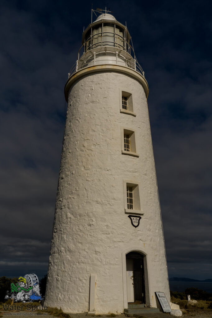
Sony A7Riv with Sony FE 24-70mm F2.8 GM II lens @ 29mm. 1/640s, f/16.0, 100 ISO.
A bit of history
The lighthouse was built in the 1830’s by convict labour, using rock quarried locally. It was the third lighthouse built in Australia, and stands on a remote southern cape of Bruny Island.
In fact, it is so remote that there wasn’t a road in to the site until 1962. While there was an 18km rough track up to more populated parts of the island, it wasn’t suitable for shipping supplies. Up to that time, equipment and supplies for the permanent keepers and their families resident there had to be shipped in by boat. Not just that, but the nearby bay isn’t suitable for loading and unloading cargo. Supplies were shipped in to a bay on the other side of the island and then carried by cart for about 5km to the lighthouse. You can see a sliver of the bay where the jetty was on the left hand side of my photo below.
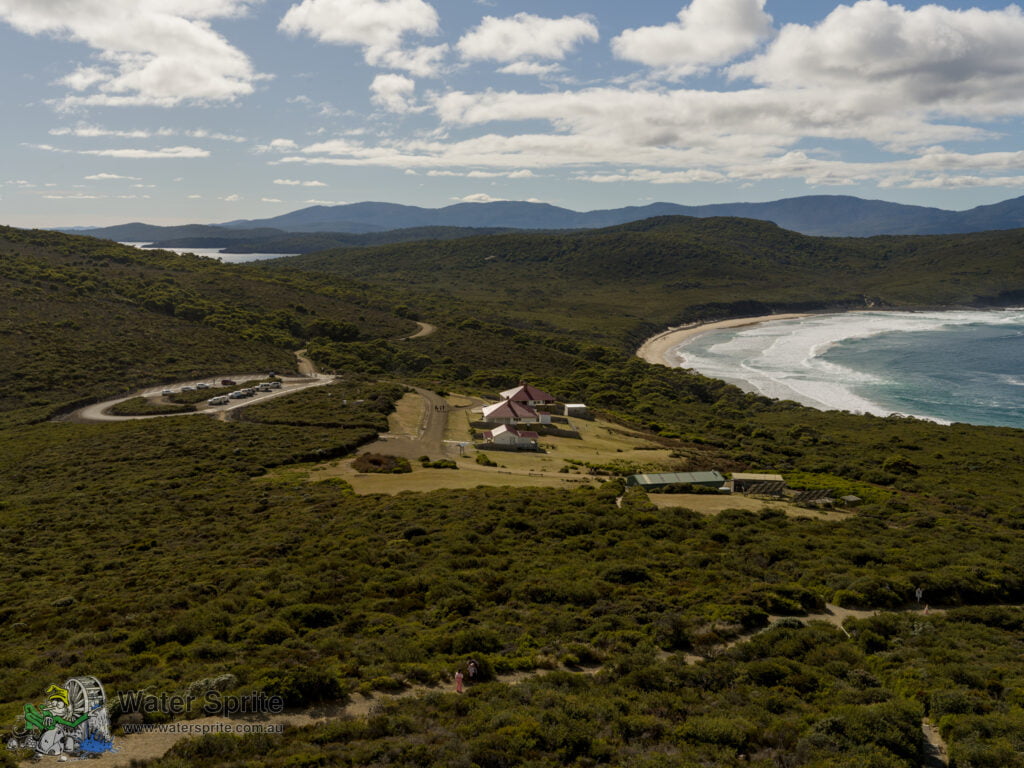
Sony A7Riv with Sony FE 24-70mm F2.8 GM II lens @ 34mm. 1/100s, f/16.0, 100 ISO.
Remote
At the time it was decommissioned in 1996, it was Australia’s longest continually manned lighthouse. There is still a navigational light on the site. On an adjacent point to the original lighthouse is a modern, much smaller, fully automated light. In 1996 the permanent resident lighthouse keepers were removed. Nowadays, the houses are used for volunteer keepers, who provide basic maintenance for the lighthouse, buildings and grounds on a roster arrangement.
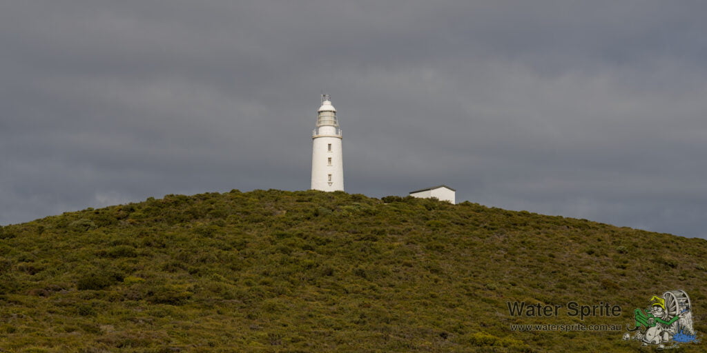
Sony A7Riv with Sony FE 24-70mm F2.8 GM II lens @ 70mm. 1/160s, f/10.0, 100 ISO.
There still isn’t mains electricity to the site. Various light and power sources have been used over the years – starting with whale oil lanterns in the 1830’s. Eventually, an electric light was installed, along with generators to provide the electricity. Nowadays, the site is powered by a solar array and batteries, which drive the automated light on an adjacent point to the lighthouse as well as powering the residences. Relics of the previous power sources remain on site, including the bases of a generator building and storage facilities for oil and fuel.
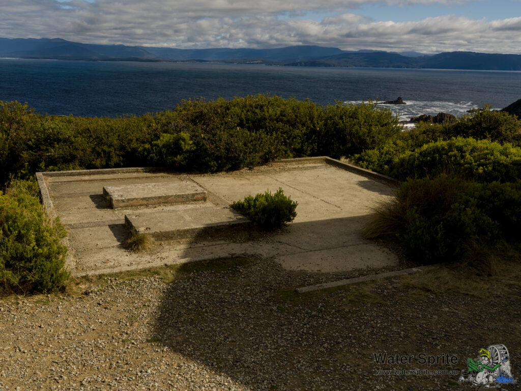
Sony A7Riv with Sony FE 24-70mm F2.8 GM II lens @ 31mm. 1/125s, f/16.0, 100 ISO.
Location
The lighthouse is located in the South Bruny National Park, and you need a Tasmanian National Parks Pass to visit. The road is dirt but otherwise seemed to be in pretty good condition. We did encounter a grader doing maintenance on the council part of the road. The National Parks section wasn’t quite as well maintained, but was still perfectly good to drive at a respectable speed.
The lighthouse is, according to the maps, further south than Southport, which we visited on the 2023 trip, which makes this now the furthest south I have ever travelled in Australia. There is a road south from near Southport, which takes you down even further south. That’s a plan for a future trip.
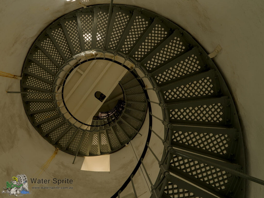
Sony A7Riv with Sony FE 24-70mm F2.8 GM II lens @ 24mm. 1/30s, f/16.0, 200 ISO.


Links
- BrunyIsland.au – Cape Bruny Lighthouse History (website)
- Bruny Island Safaris (website) – operators of the Lighthouse Tour
Fluted Cape Walk
After a brief stop in Adventure Bay for refreshments (and toilet stop), we drove out to the Fluted Cape Walk carpark. We didn’t do the full Fluted Cape Walk, but stuck to the shorter walk out to Grass Point and back.
Unexpected History
I wasn’t expecting history here, but it was interesting to learn that there were a number of whaling stations along the side of the bay. Grass Point itself was the site of one of the whaling stations, and is where the most obvious ruins are, in the form of a pile of rocks that once upon a time used to be the residence for the manager of this whaling station.
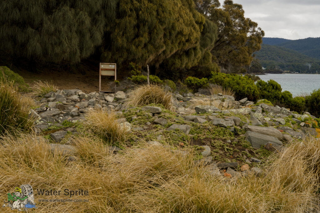
Sony A7Riv with Sony FE 24-70mm F2.8 GM II lens @ 62mm. 1/80s, f/16.0, 500 ISO.
Signage elsewhere on the walk suggests that at one time there were at least three whaling stations operating along this 1.5km stretch. Once you know to look out for them, there are a few other piles of stones along the length of the walk that might suggest locations for other buildings. These locations do not come with informational signage, however, so there is no real confirmation of that theory. The best I have to go on is that piles of stones do appear to be an unusual occurrence for the local geography which suggests that they are man-made.
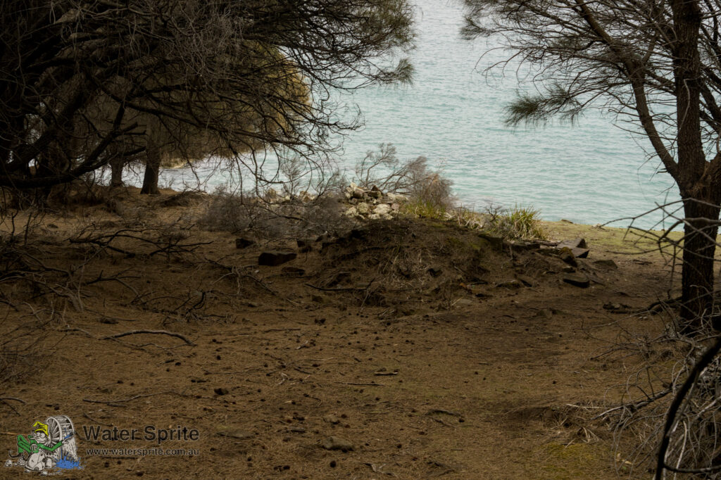
Sony A7Riv with Sony FE 24-70mm F2.8 GM II lens @ 53mm. 1/60s, f/16.0, 1600 ISO.
The walk
We were doing this walk in the afternoon, and the weather was closing in, so we decided not to do the full Fluted Cape walk. As I’ve mentioned in previous posts, when walking with a mad photographer, it does take quite significantly longer to complete the walk. While normal walkers could probably complete the entire Fluted Cape walk in under 2 hours, we spent that long just doing the walk to Grass Point and back along the easy bit of the track.
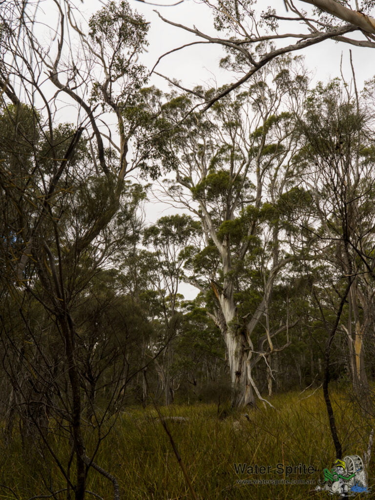
Sony A7Riv with Sony FE 24-70mm F2.8 GM II lens @ 25mm. 1/30s, f/16.0, 160 ISO.
It isn’t a hard (or long) walk, and we were passed by a few of families with children. The information suggests that the full Fluted Cape Walk is a bit more challenging, but the bit out to Grass Point is basically a moderately easy walk along a well marked bush track. It is a bush track, with all the dips and bumps that suggests, so might be challenging to people with reduced mobility. Definitely NOT wheelchair suitable, but a fit person on crutches should be able to do it.


Links
Kunanyi (Mt Wellington)
Kunanyi looms behind Hobart, and is easily the most noticeable point in the surrounding terrain. Standing just over 1200m high, with the telecommunications pinnacle on the top, it is instantly recognisable.
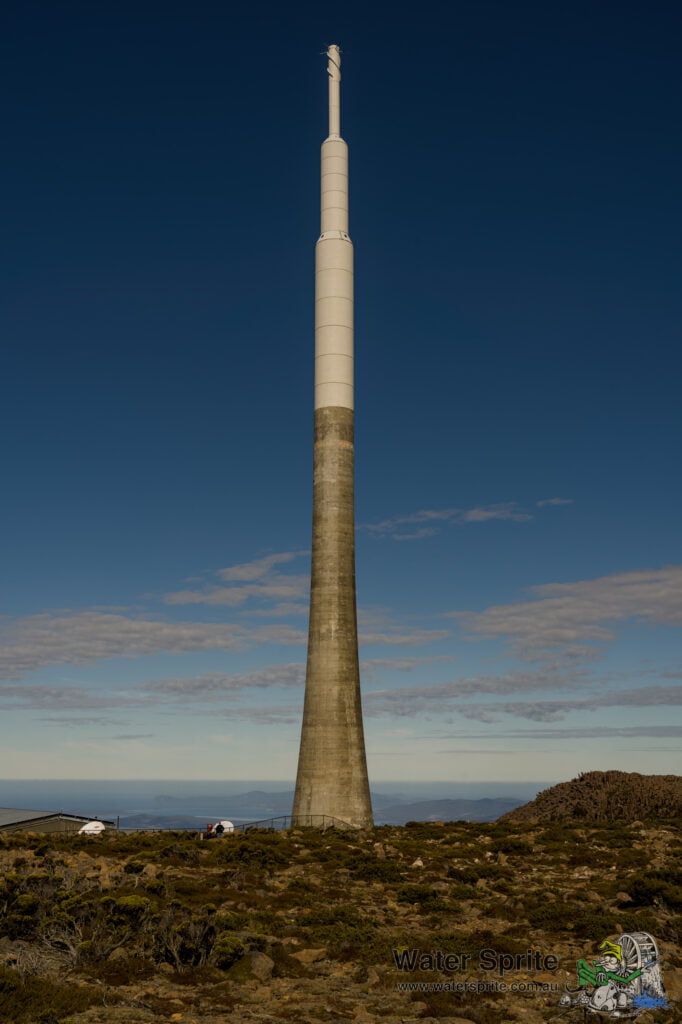
Sony A7Riv with Sony FE 24-70mm F2.8 GM II lens @ 40mm. 1/500s, f/10.0, 100 ISO.
There were lots of people up there, which made getting good photographs difficult. It is very obviously a popular spot, and it isn’t actually that hard to get to (by car anyway) from Hobart. It was very windy (I gather that is normal) and rather cold (which I also gather is quite normal). Being alpine, there is not much growing up here, other than some pretty tough looking ground covers. There’s a decent sized plateau up here, which is interesting in it’s own way, but really not terribly exciting photo-wise unless you like alpine plateaus.
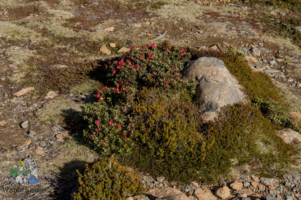
Sony A7Riv with Sony FE 24-70mm F2.8 GM II lens @ 70mm. 1/160s, f/10.0, 100 ISO.
Panoramas
I took a number of multi-shot panoramas, one of which worked satisfactorily. The trouble with shooting multishot panoramas hand-held is keeping the various angles of the shots consistent so they will stitch together properly. One of the other sequences I shot, I have dropped the front of the lens down mid-sequence, which distorts how the panorama stitches together. I have had to abandon that one. Here instead is a horizontal single-shot of what would have been approximately the right-most (southern) third of the failed panorama, looking down on Hobart city.

Sony A7Riv with Sony FE 24-70mm F2.8 GM II lens @ 24mm. 1/320s, f/10.0, 100 ISO.
The one taken from the highest point by the carpark covers nearly 180 degrees of view. At full resolution on my monitors I can identify South Bruny Island and the Tasman Peninsula and up the Derwent river almost to the Bowen Bridge. It won’t look as impressive at the resolution I have to load here, but it is still quite amazing. Adventure Bay is about 40km away, and you can’t make out any details at that distance, but the shape is very definitely identifiable.

13 x Sony A7Riv with Sony FE 24-70mm F2.8 GM II lens @ 70mm. Stitched with Hugin Panorama Processor.
Disclaimer
We attended the establishments and locations mentioned in this post as full fee-paying guests. Our hosts were not advised that we are semi-professional photographers or bloggers before or during our visit. It is our understanding that the tours and information we received were as normally provided to any member of the public.
The views expressed in this post are mine and mine alone, and any errors in it are also all mine. Any recommendations made in this post are unpaid and are based entirely on my experiences during my visit. Your experience may differ, and I cannot be responsible for that.
Neither Tasmanian Parks and Wildlife Service nor the Wellington Park Trust (managers of Kunanyi) permit commercial photography without a prior licence. The information presented in this post is an account of my travels and experience and is presented for information only. I do not hold a commercial photography licence from either the Tasmanian Parks and Wildlife Service or the Wellington Park Trust. These photographs are not for sale or distribution.
Leave a Reply