As I mentioned last week, I went for a drive out to Tidbinbilla the other weekend. (See here). On the way home I stopped in on a couple of other sites to see along that stretch of road. First, I visited the Canberra Deep Space Communication Complex. From there, I went and got some photographs of the Cotter Dam overflowing.
The Canberra Deep Space Communication Complex
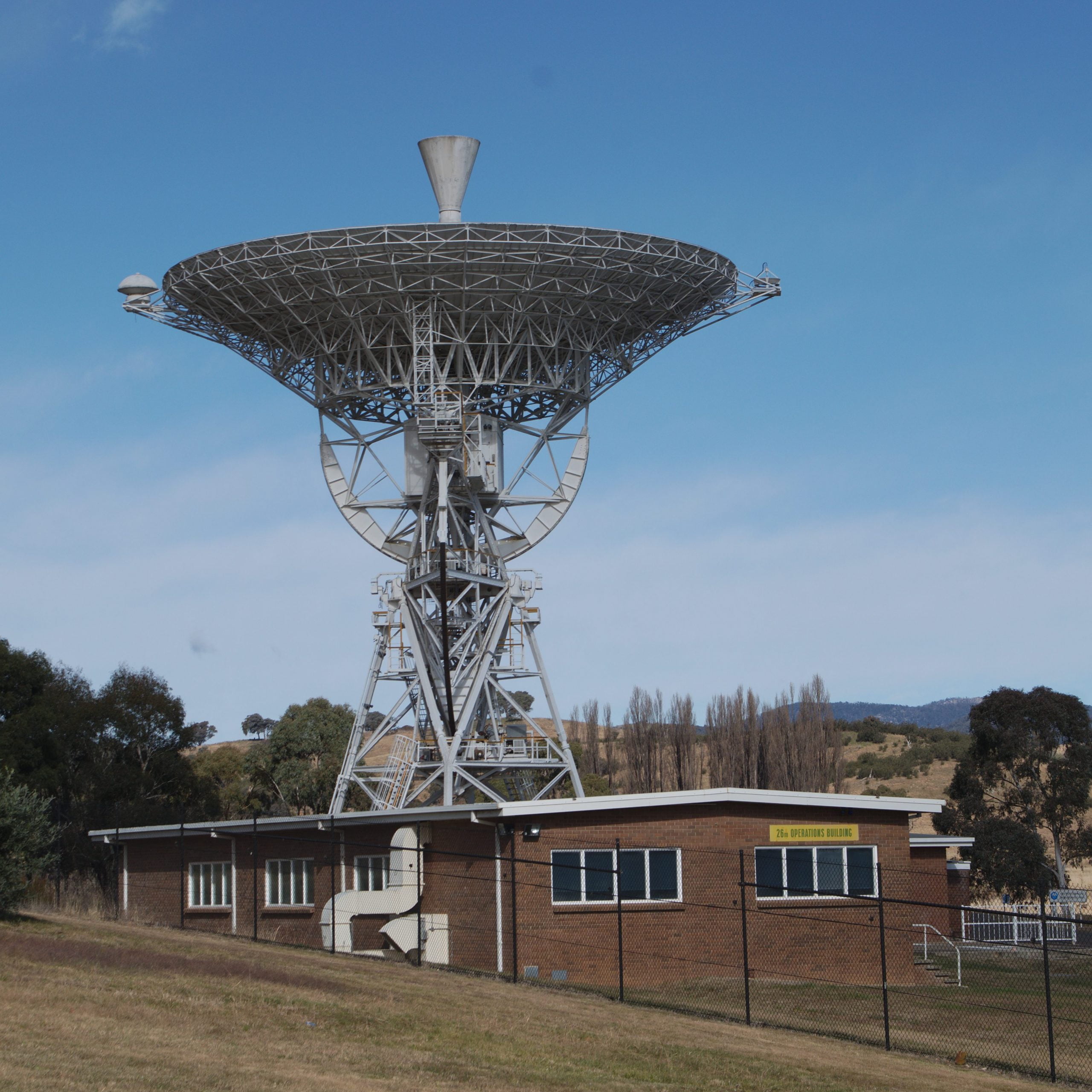
Locally known as “the Tracking Station” or “Tidbinbilla Tracking Station”, the Canberra Deep Space Communication Complex is a key part of the communications network that supports spacecraft from NASA and other space organisations. This station isn’t (usually) involved in communications with stuff orbiting the Earth. It is designed and built to communicate with spacecraft outside of near-Earth orbit. It has four dishes dedicated to that purpose, including a couple built in the last 10 years.
One big step for a man, one little dish for mankind…
It does have some history with near-Earth activities, however. While it made a good story, the movie “The Dish” was not entirely accurate. Now located at this site is the actual dish that received the start of the iconic TV transmission of the first step on the moon.
The dish at Parkes had been organised to receive the TV signal. It’s big dish could receive much more of the faint signal from the moon, and would therefore give a much clearer TV picture than other dishes available to NASA at the time. Due to the timing, however, the Parkes dish wasn’t able to clearly “see” the moon at the start of the broadcast. To fill that gap, an alternative was required.
Approximately 35 km south(ish) of the Canberra city centre, the Honeysuckle Creek Tracking Station had been established by NASA to provide tracking and communications for the moon missions. Honeysuckle Creek was being used on the day to provide communications to the moon mission. It also had the communication links necessary to provide the TV signal to the world. Honeysuckle Creek was an obvious solution.
Sometimes fate intervenes
According to the information boards on site, the Goldstone station in the United States was also receiving the signal and could also have been used. However, someone had plugged a connector in the wrong way, and the TV picture from Goldstone was coming out upside-down! By a quirk of fate and timing, our dish took the glory!
If you are looking for it, you can pick the point in the original footage where the quality of the TV signal becomes noticeably better. That is the point where the reception switched over to the Parkes dish. Prior to that point, this little dish, located just outside of Canberra, had been receiving that signal for the world.
After the moon landings…
This dish supported the subsequent moon missions, along with the other dishes in the NASA network. It transmitted and received command and information signals from the spacecraft, and allowed communication with the astronauts. When the moon program finished, it transitioned to the Deep Space Network as DSN44. In this role, it was used to communicate with spacecraft exploring our solar system. In the 1980’s, Honeysuckle Creek Station was closed, and the dish was disassembled and relocated to Tidbinbilla. With a refurbishment, it continued to perform valuable duties communicating with spacecraft as DSN 46. Maintenance became expensive, however, and in 2010 it was finally shut down. While it has now been retired, it is preserved in recognition of it’s contribution to the historic moon landing and early exploration of the solar system.
The Visitor’s centre
Sadly, the visitor’s centre and cafe at the tracking station are still closed after COVID. This meant I was not able to get much in the way of information or photographs for more story. I do have quite a few photographs from previous visits (including a couple of on-ground tours), so maybe at some point in the future I can do a full story.
It’s a big shame the visitors centre is closed, as it was always a fantastic place to visit. Lots of information about all sorts of things space-related. I do, however, have to declare some bias here. I enjoyed the 18 months or so I ran the Cafe there. It was, at that time, known as the Moonrock Cafe. That’s a story for another day, however. Hopefully they will be able to re-open soon.
Cotter Dam overflowing
Anyone local will attest that last summer was very wet by normal standards for this part of the world. That has moderated somewhat lately, but there is still plenty of moisture in the soil. One of the major water supply dams for Canberra is also on this loop of road. I observed on the drive out to Tidbinbilla that it appeared to be overflowing. If you are coming along the road from the Weston Creek end, the dam is quite clearly visible in a couple of spots. I had observed on the drive out that it looked like the dam was overflowing, so as I decided to stop in and take a look. I ended up spending a couple of hours here walking around and taking photos.
Success?
Not many particularly good results, but lots of experimentation. I spent quite a bit of time trying to capture the spectacle, without a huge amount of success. I probably would have done much better with video, as the roar of the water as it spills down the spillway was really quite something. However, I did capture a few shots that hint at the amount of water spray in the air around the spillway.
I hadn’t looked at the river from where I had parked and looking down at the water near the footbridge I was on (nearest the dam wall), it didn’t look all that deep or fast moving. That was deceptive, as became apparent as I walked around the discovery trail. Actually it was still in flood, despite the levels of rainfall having been far more reasonable for the last month or so.
Damage from the flooding
Once you see the (lower) footbridge down near the swimming hole, you start to appreciate just how high it currently is. And the scary thought – it’s a lot lower than it has been. In the photo of the damaged footbridge, the wooden top railings are missing even on side segments that are still upright. That can only have happened if water was flowing OVER those sides. That would be a good 1.5m higher than it currently is.
I have included a few more photos for your amusement in the gallery below. Enjoy.
[Best_Wordpress_Gallery id=”23″ gal_title=”Cotter dam overflowing”]
Leave a Reply